
Facebook is working hand in hand with some non-profit research partners on ways with which Artificial intelligence (AI) can tackle massive health and infrastructural challenges in Sub-Saharan Africa. This includes sorting rural electrification and vaccinating people in Tanzania and Malawi. Facebook is leveraging on its technological prowess, extensive data science skills, expertise in AI and machine learning to roll out a detailed and accurate map of local populations.
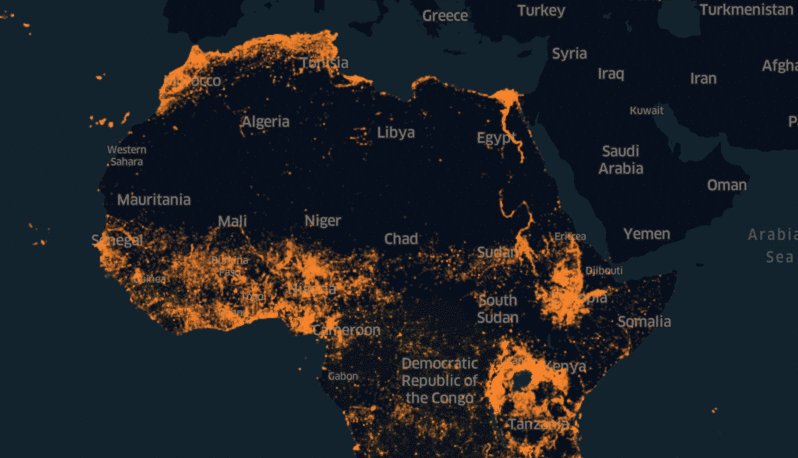
Facebook is in partnership with Columbia University’s Center for International Earth Science Information Network (CIESIN) to guarantee that this effort uses the best administrative data for all countries involved. The Facebook team in Boston uses advanced computer vision and machine learning to obtain satellite imagery from Digital Globe with public census data and other sources to create detailed population density maps of Africa. Leveraging on Facebook’s machine learning capabilities, Facebook has started developing population density maps with aims to provide better tools to aid connectivity efforts around the world.
Laura McGorman, a public policy manager at Facebook said “Having started my career at USAID working on malaria control, I have witnessed first-hand the critical role that accurate data plays in the effectiveness of humanitarian efforts.”
See also: Fintechs: Bridging the Digital Banking Horizon in Africa
Laura continued, “What’s exciting about projects like these that they provide an opportunity for our company to contribute to these efforts through our expertise in data and machine learning.”
Missing Maps Project used these AI-powered maps in Malawi to filter out the 97% of the uninhabited part of the country. The project helped in boosting 3,000 Red Cross volunteers in Malawi who visited roughly 100,000 houses in just three days to educate people about measles and rubella vaccines.
Facebook’s AI-powered maps also spearheaded the efforts to bring renewable electricity to rural areas in Tanzania. The humanitarian OpenStreetMap team in Tanzania collaborated with the Reiner Lemoine Institut and Integration Environment and Energy to combine Facebook’s population maps with detailed data on settlement locations and structures from OpenStreetMap. This is to understand which locations would benefit most from decentralized energy solutions.
Tyler Radford, executive director of the Humanitarian OpenStreetMap Team, which is part of the Missing Maps Project said “The maps from Facebook ensures we focus our volunteers’ time and resources on the places they’re most needed, improving the efficacy of our programs.”